Interactive General Land Use Plan (GLUP) Map shows minimal change in Arlington’s land use in over 60 years
October 14, 2026
We cannot solve 21st-century challenges with a 20th-century map. It’s time to finally embrace land use that reflects the world-class, inclusive community we deserve.
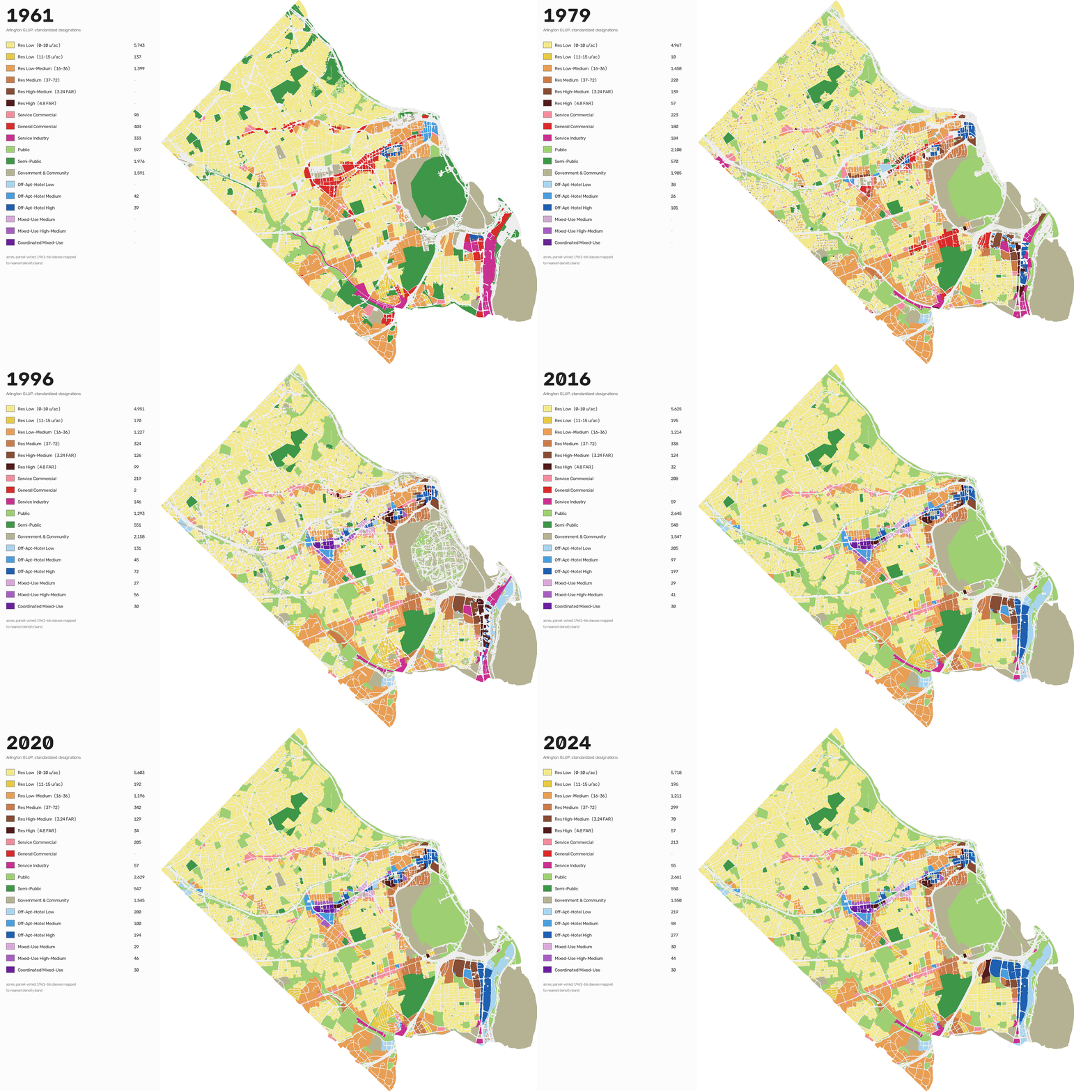
Arlington is the vibrant heart of our region, but our housing rules are stuck in the past. For over 60 years, our growth has been dictated by an obsolete 1961 land-use plan that forces almost all new development into a few narrow corridors.
Since our land-use plan was adopted, our region has added 4 million people, built the nation’s second-busiest Metro system, and grown into a $750 billion economic powerhouse. Yet 79% of Arlington’s residential land has remained frozen in time.
You can see this for yourself in our newly-released interactive General Land Use Plan (GLUP) Map. You can select GLUP Maps from 1961 to 2024, and compare different versions side by side. This tool shows how little of Arlington’s land area has allowed for greater density in more than half a century.
We cannot solve 21st-century challenges with a 20th-century map. It’s time to take a serious look at our General Land Use Plan (GLUP) and unlock diverse housing options across the entire county, not just the Metro corridors. By spreading growth equitably, we can create vibrant, walkable, and attainable neighborhoods for everyone. It’s time to finally embrace land use that reflects the world-class, inclusive community we deserve. Join us in advocating for an Arlington that has room for everyone.